Day 1’s first major ruin complex across the valley — known as Patallaqta or Llactapata depending on who is talking.
Patallaqta / Llactapata
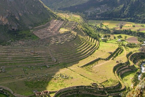
Patallaqta (also called Llactapata in many trek materials) is a large Inca complex seen on Day 1, set across the valley early in the classic itinerary. It is often an “overview from the trail” experience more than a deep interior tour — your guide’s schedule and park rules decide how close you get.
Elevation in our guide copy is about 9,000 ft (2,743 m).
Why it matters
The complex is commonly described as an administrative / agricultural support site tied to the wider Machu Picchu road system — a reminder that the trail is infrastructure, not only scenery. For hikers it is the first major ruin “wow” before camps and high passes dominate the story.
PATALLAQTA · hash #patallaqta.
Practical tips
- Have the camera ready — many views are from the trail bench, not a long side hike.
- Listen for the Llactapata vs Patallaqta naming; guides use both.
- Don’t lag too long; Day 1 still has miles to Camp 1.