A compact, rounded tambo above the valley — the architectural warm-up before Day 3’s second pass.
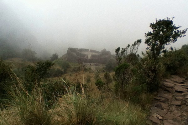
Runkurakay ruins
Runkurakay (Runcu Raccay / Runkuracay spellings appear) is a compact Inca site on Day 3, climbed to after leaving Camp 2. It is often described as a tambo (waystation) with a distinctive rounded / oval footprint overlooking the valley.
Our guide elevation band is about 12,000 ft (3,600 m).
What to look for
- Unusual circular/oval plan compared with rectangular compounds elsewhere
- Commanding views back over the Day 2 valley when clear
- A short, steep approach that wakes the legs for Runkurakay Pass next
Popular interpretation: rest and control point for travelers on the royal road. As always, guide stories vary; the architecture and setting are the durable facts for hikers.
GPS note. Waypoint
RUNKURAKAY · hash #runkurakay.
Practical tips
- Short photo stop — Day 3 is long.
- Wind can be sharp on the knoll.
- Save energy for the pass immediately beyond.