The high valley camp after the hardest day — relief, cold air, and the start of Day 3’s ruin-rich itinerary.
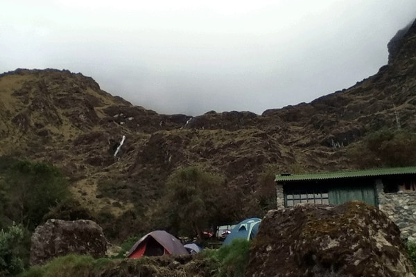
Camp 2 at Pakaymayu
Pakaymayu (Pacaymayo / Pacaymayu — spellings vary) is the usual Camp 2 after the brutal climb and descent around Dead Woman's Pass. Our elevation is about 11,781 ft (3,590 m) — still high, but a psychological relief after the saddle.
Quechua-oriented popular glosses sometimes render the name in connection with a “hidden” or silver-colored river valley; treat poetic translations as guide color unless a linguistic source is cited.
After the hardest day
- Recovery time for quads after the stone descent
- Colder nights than Camp 1
- Briefings for Day 3’s second pass and ruin-dense itinerary
- Often one of the most scenic high valleys on the route
GPS note. Waypoint
CAMP 2 · tour hash #camp-day-2 (hash spelling differs from URL slug).
Practical tips
- Stretch calves/quads; tomorrow still has climbs.
- Change out of damp Day 2 clothes quickly.
- Hot drinks and calories matter more than heroics.
- Prep headlamp and layers for Day 3 early starts if scheduled.